Minneapolis - St Paul International Airport (MSP)
Driving Directions / Travel by Car
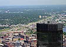
(Minneapolis, Minnesota - MN, USA)
Located on the southern side of both Minneapolis and St. Paul, the Minneapolis - St Paul International Airport (MSP) is shared between the two twin cities. Less than a 40-minute drive from each of the cities, Minneapolis - St Paul Airport lies off the I-494 interstate, sandwiched between Mendola to the east and Richfield to the west.
Notable landmarks close to Minneapolis Airport include the Army Reserve Fort Snelling to the north, and the Fort Snelling National Cemetery to the south. Also nearby is Long Meadow Lake and the Fort Snelling State Park.
Skirting the eastern side of the airport, the US-5 highway leads into the grounds, via Northwest Drive and Giumack Drive. On the western side, the US-77 (Cedar Avenue) passes the Mall of America along the way, while the US-62 highway borders the northern side of the grounds.
Directions to Minneapolis - St Paul International Airport (MSP) from the north:
- Travel along Highway US-35W and head in a southerly direction
- Travel on Highway US-62 and head west
- Travel on Highway US-5 and head west, following the signposts
Directions to Minneapolis - St Paul International Airport (MSP) from the south
- Travel along Highway US-35W and head in a northerly direction
- Travel along the I-494 interstate and head east
- Travel along Highway US-5 and head east, following the signposts
Directions to Minneapolis - St Paul International Airport (MSP) from the east
- Travel along the I-494 interstate and head in a westerly direction
- Travel along Highway US-5 and head east, following the signposts
Directions to Minneapolis - St Paul International Airport (MSP) from the west
- Travel along the I-494 interstate and head in an easterly direction
- Travel along Highway US-5 and head east, following the signposts
Minneapolis Saint Paul International Airport (MSP): Virtual Google Maps
